Girona Costa Brava Airport (GRO)
City Orientation and Maps
(Girona, Catalonia, Spain)
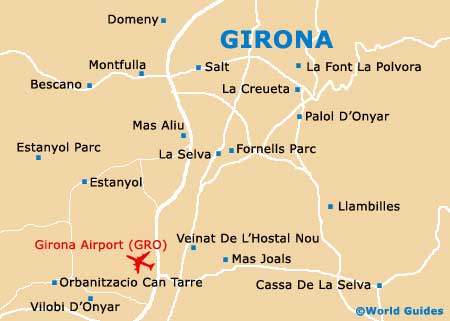
Girona is located on the north-western edge of Spain, close to the south of France, lying just 100 km / 60 miles north of Barcelona and around approximately 380 km / 236 miles east of Zaragoza. Other nearby towns, villages and locations include Cantallops, Figueres, Creixell and Banyoles to the north, and Tordera, Blanes and Mataró to the south. The Mediterranean Sea lies on the eastern side of Girona, while Manresa, Granollers and Igualada are all sited to the south-west, together with Girona Airport, which is situated just minutes away from the city.
Girona Costa Brava Airport (GRO) Maps: Important City Districts
Girona is the largest city in the whole of northern Catalonia and enjoys a valley setting, being around 36 km / 22 miles inland from Palafruggell. Known for its medieval past and rich heritage, central Girona contains some true treasures, including period Gothic-style architecture and narrow streets around the old town area, to the east of the Riu Onyar river. The new town area of Girona is sited across the river and is connected by a series of bridges.
Girona's train station can be found on the south-western side of the city, on the Plaça d'Espanya, next to the Carrer de Barcelona. The bus station is also located in this area, along the Carrer de Rafael Masó i Valenti.
Spain Map

Girona Map